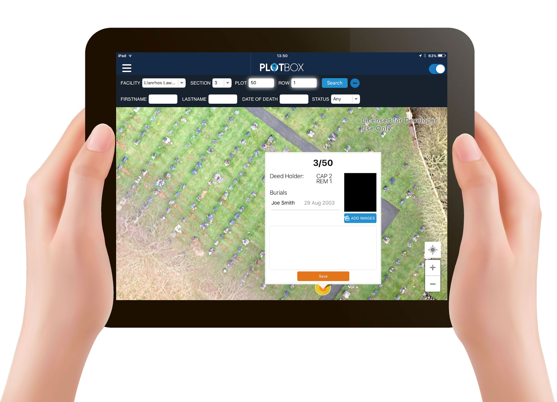
In today's tech-driven landscape, the concept of digital mapping has permeated various industries, and the realm of cemeteries is no exception. Amidst the multitude of digital mapping solutions available, a novel approach has emerged - one that holds the key to revolutionising cemetery operations. Welcome to the world of Digital Cemetery Mapping, an innovation that promises accuracy, connectivity, and operational efficiency like never before.
Decoding Digital Cemetery Mapping
At its core, the term 'digital' implies the representation of information on electronic devices, be it computers, smartphones, or tablets. However, true digital mapping for cemeteries delves deeper than mere digital representations. Enter the concept of 'True' Digital Mapping, championed by experts like PlotBox. This approach entails an accurate visualisation of cemetery plots and inventory on a device seamlessly connected to reliable data sources.
The authenticity of 'true' digital mapping rests on two pillars. Firstly, it incorporates survey expertise, ensuring that the visualised data accurately reflects the physical reality of the cemetery. Secondly, and perhaps most crucially, it is intrinsically linked to trustworthy data sources, eradicating the risk of discrepancies.
The Evolution of Cemetery Mapping
Before the advent of 'true' digital mapping, various mapping methods were employed in cemetery management:
-
Hand Drawn Paper Maps: Some paper maps date back centuries, representing an antiquated approach susceptible to inaccuracies due to changing equipment and expertise.
-
Map Books: These segmented maps are prone to errors, potentially leading to operational inefficiencies.
-
Lot Cards: Often stored in extensive cabinets, managing and tracing these cards can be a monumental challenge.
-
GIS Systems: Incorporating software like Map Info, Esri, and even older systems like Palm Pilot, these tools presented advancements but lacked the comprehensive accuracy of 'true' digital mapping.
-
Digitally Recreated Maps: A precursor to modern digital mapping, these maps traced paper versions and served as basic representations, but lacked the authenticity of true mapping.
-
CAD Drawings: While offering high-quality visualizations, these drawings varied in quality and were not always based on precise surveys.
The Data Connectivity Conundrum
While various mapping methods have provided insights over the years, the true essence of digital cemetery mapping lies in data connectivity. Having a map, whether digital or on paper, is only half the battle. The pivotal question is: Is your map intrinsically linked to reliable data sources? Without this connection, the map's value diminishes, hindering confident decision-making and seamless operations.
Unlocking the Benefits of 'True' Digital Mapping
Embracing 'True' Digital Mapping ushers in a host of benefits that amplify cemetery operations:
-
Mitigate Risk: By ensuring accuracy and connectivity, the risk of errors and legal complications is drastically reduced.
-
Enhance Efficiency: Time and resources are saved through streamlined operations enabled by accurate digital mapping.
-
Facilitate Communication: Improved interaction between grounds crews, administrative personnel, and sales staff fosters cohesive operations.
-
Amplify Visibility: 'True' digital mapping provides unprecedented insights for future planning, aiding in decision-making and resource allocation.
-
Elevate Revenue: With increased accuracy and streamlined processes, pre-need sales and revenue generation witness an upswing.
In conclusion, digital cemetery mapping transcends conventional mapping methods, introducing accuracy, connectivity, and operational efficiency to cemetery management. The era of 'True' Digital Mapping has arrived, promising a transformation in the way cemeteries are managed and operated, ensuring a seamless blend of tradition and technology for generations to come.
